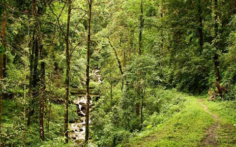
Dooars
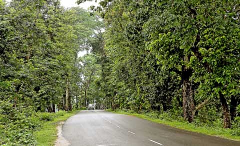
A journey through the rolling hill slopes, widespread lush green tea gardens separated by meandering silvery mountain streams, high Sal forests, small quiet ethnic villages, vast meadows with a blue outline of the great Himalayan ranges in the horizon, endless sky..... you are in Dooars!
Laying in the Himalayan foothills, Dooars has great natural beauty. The wildlife-rich tropical forests, innumerable hill streams cutting across the green carpet of tea gardens and undulating plains, low hills rising up from the rivers. A drive through the Dooars plains, the gateway of Bhutan and the entire North East of India can be the experience of a lifetime.
History of Dooars
The Dooars belonged to the Kamata Kingdom under the Koch dynasty; and taking advantage of the weakness of the Koch kingdom in subsequent times, Bhutan took possession of the Dooars. This region was controlled by the kingdom of Bhutan when the British annexed it in 1865 after the Bhutan War under the command of Captain Hedayat Ali. The area was divided into two parts: the eastern part was merged with Goalpara district in Assam and the western part was turned into a new district named Western Dooars. Again in the year 1869, the name was changed to Jalpaiguri District. After the end of the British rule in India in 1947, the Dooars acceded into the dominion of India and it merged with the Union of India shortly afterwards in 1949.
Places of Interest
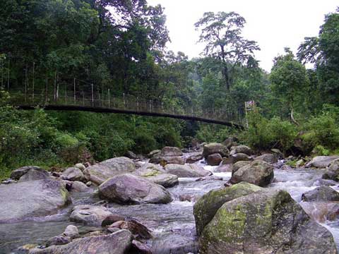
 Jayanti
Jayanti is a small forest village within Buxa Tiger Reserve in Alipurduar district of West Bengal, India. It is located along the Jayanti River, forming a natural border with the Bhutan hills. It is popular with hikers for its views of the surrounding landscape and wild fountains. A 13 km trek from Buxaduar to Jayanti passes through the dense forest of the Buxa Tiger Reserve. Jayanti also features a stalactite cave known as the Mahakal cave. The nearest railway station is Rajabhatkhawa on the New Jalpaiguri-Alipurduar-Samuktala Road Line.
 Bhutanghat
Bhutanghat is a village in the Alipurduar district of West Bengal. It is about 45 kilometres (28 mi) away from Alipurduar and is a tourist destination.
 Buxa Fort
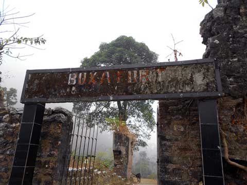
Buxa Fort is located at an altitude of 867 metres (2,844 ft) in the Buxa Tiger Reserve, Alipurduar district, West Bengal. It is located 30 kilometres (19 mi) from Alipurduar, the nearest town. The Bhutan King used the fort to protect the portion of famous Silk Route connecting Tibet with India, via Bhutan. Still later during unrest in Occupation of Tibet, hundreds of refugees arrived at the place and used the then abandoned fort as refuge.
 Malbazar
Malbazar, also known as Mal, is a city and a municipality in Jalpaiguri district in the state of West Bengal, India. It is the headquarters of the Malbazar subdivision. It lies about 65 km from Jalpaiguri and 55 km from Siliguri.
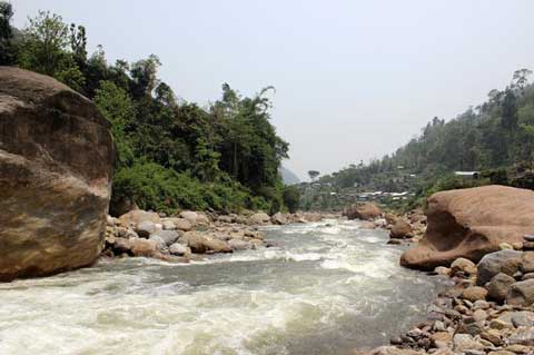
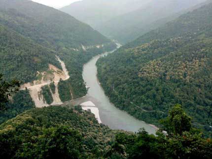 Teesta River
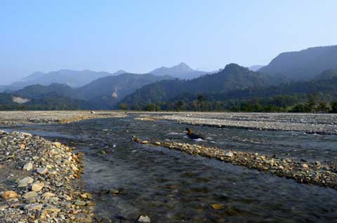
Teesta River (or Tista River) is a 315 km (196 mi) long river that rises in the eastern Himalayas, flows through the Indian states of West Bengal and Sikkim through Bangladesh and enters the Bay of Bengal. It drains an area of 12,540 km2 (4,840 sq mi). It forms the border between Sikkim and West Bengal. In India, it flows through the cities of Rangpo, Kalimpong, Jalpaiguri and Mekhliganj. It joins the Jamuna River at Fulchhari in Bangladesh.
 Hasimara
Hasimara is a Small Village in the Alipurduar district of West Bengal state, India near the border with Bhutan. It is located at 26° 45' 0N latitude and 89° 20' 60E longitude at an altitude of 109 metres above sea level and has a population of about 40,000 (2001 census).
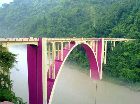 Coronation Bridge
The Coronation Bridge, also known as the Sevoke Bridge, in Darjeeling district of West Bengal, India, spans across the Teesta River, connecting the districts of Darjeeling and Jalpaiguri. National Highway 31 runs across it. It was named to commemorate the coronation of King George VI and Queen Elizabeth in 1937 and was completed in 1941 at a cost of Rs 4 lakhs. The foundation stone of the bridge was laid by John Anderson, the-then Governor of Bengal in 1937.
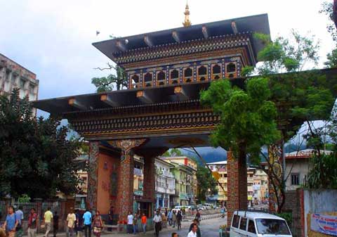 Phuntsholing
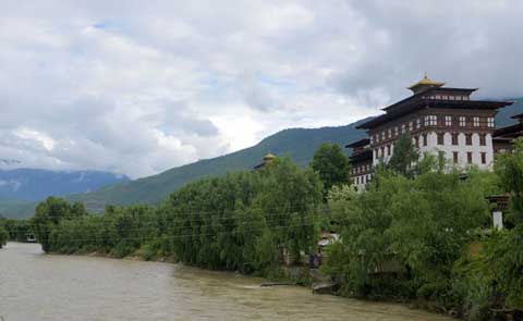
Phuntsholing, also spelled as Phuentsholing, is a border town in southern Bhutan and is the administrative seat of Chukha District. The town occupies parts of both Phuentsholing Gewog and Sampheling Gewog. Phuentsholing adjoins the Indian town of Jaigaon, and cross-border trade has resulted in a thriving local economy. The town has the headquarters of the Bank of Bhutan previously but shifted to Thimphu. In 2017, Phuentsholing had a population of 27,658.
 Chalsa
Chalsa is a small town situated just on the foot of the Himalayas in the Duars in Jalpaiguri district in West Bengal. This small town is surrounded by hills, tea gardens, rivers and forests. One part of the town is surrounded by Gorumara National Park and other part with Chapramari Wildlife Sanctuary. Nearby forests are residence of a good collection of elephants and rhinos. It is situated on the way towards Birpara or Alipurduar from Siliguri via Malbazar. It takes around 1.5 hours from Siliguri both on road and railways. It is 60 km from Bagdogra airport.
 Rajabhatkhawa
Rajabhatkhawa is a small town situated just outside the Buxa Tiger Reserve in the Alipurduar district of West Bengal, India. It is known for its natural environment, and is surrounded by forest. All the permits for the entry to the Buxa Tiger reserve can be taken from here.
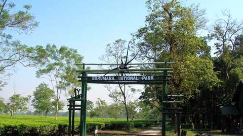
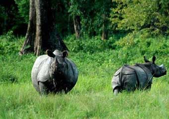
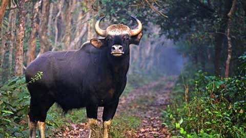 Jaldapara
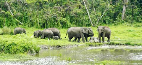
Jaldapara National Park (Bengali: জলদাপাড়া জাতীয় উদ্যান) (formerly Jaldapara Wildlife Sanctuary) is a national park situated at the foothills of the Eastern Himalayas in Alipurduar District of northern West Bengal and on the banks of the Torsa River. Jaldapara is situated at an altitude of 61 m and is spread across 216.51 km (83.59 sq mi) of vast grassland with patches of riverine forests. It was declared a sanctuary in 1941 for protection of its great variety flora and fauna. Today, it has the largest population of the Indian one horned rhinoceros in the state, an animal threatened with extinction, and is a Habitat management area (Category IV). The nearby Chilapata Forests is an elephant corridor between Jaldapara and the Buxa Tiger Reserve near by is the Gorumara National Park, known for its population of Indian rhinoceros.
 Jaldhaka River
The Jaldhaka River (Bengali: জলঢাকা নদী), also known as Dichu River in earlier times, is a trans-boundary river with a length of 192 kilometres that originates from the Kupup or Bitang Lake in southeastern Sikkim in the eastern Himalayas and flows through Bhutan and the Kalimpong, Jalpaiguri and Cooch Behar districts of West Bengal, India. At that point the river enters Bangladesh through the Lalmonirhat District and then joins with the Dharla River until the Dharla debouches into the Brahmaputra River near the Kurigram District. Due to the river's wandering over several international borders, only a small length of the river lies within Bangladesh.
 Sitai
Sitai
Sitai (community development block) is an administrative division in Dinhata subdivision of Cooch Behar district in the Indian state of West Bengal. Sitai police station serves this block. Headquarters of this block is at Sitai.
 Kunganagar
The place is home to an amusement park called the Kunjanagar Eco Park. Tourists can spot elephants, deer, and sometimes leopards here as well. The park also has facilities for boating. Other than that, Kunjanagar has a suspension bridge, a centre for wild animal rescue operations, and a watchtower. It is believed that the town of Kunjanagar was once a shelter to Netaji Subhas Chandra Bose, who had stayed in the Soulmari Ashram here.
 Falakata
Falakata is a historic census town of Alipurduar subdivision in Alipurduar district in the state of West Bengal, India.